Former River Road Golf Course · London, Ontario

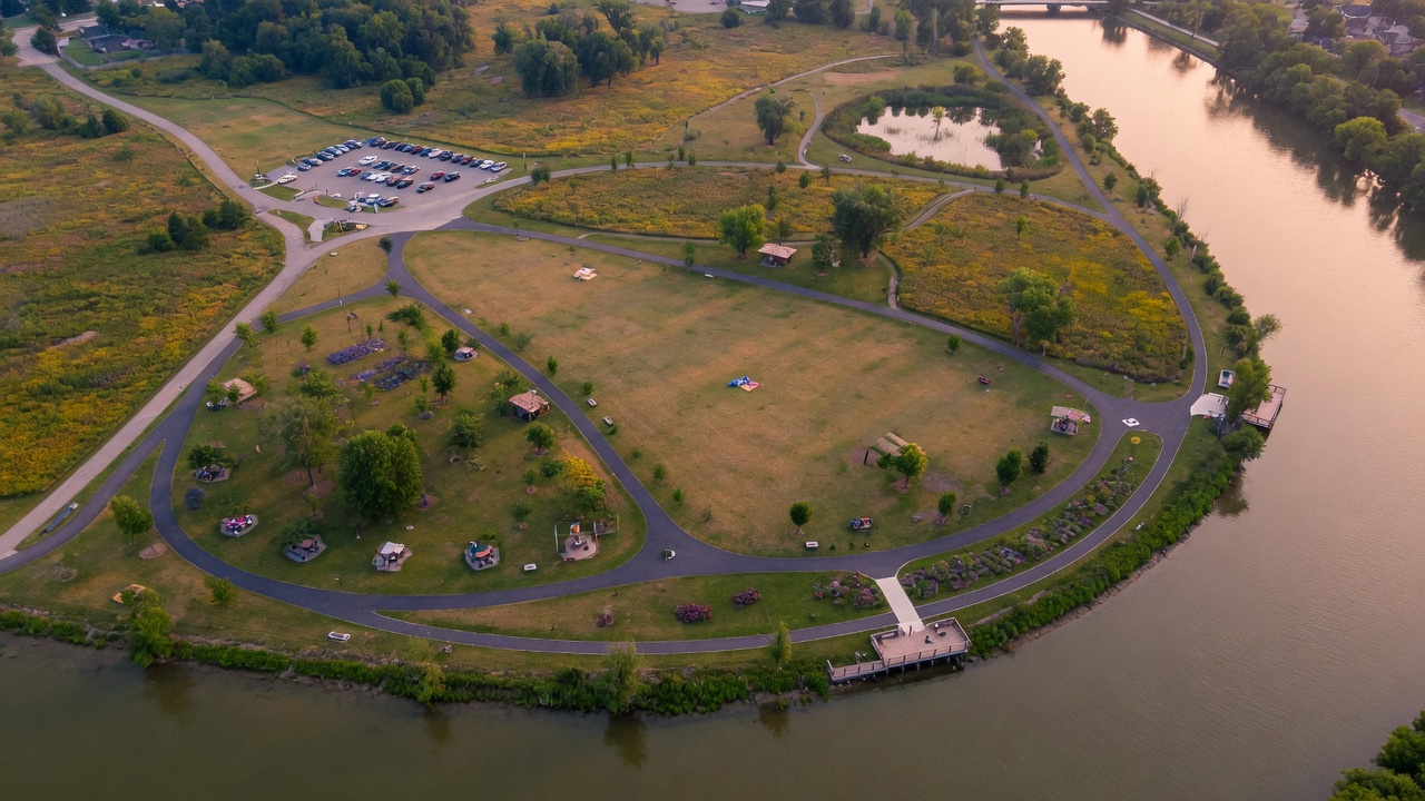
133 acres on the Thames.
Let's make it a park for everyone.

The city's own report recommends turning most of the former River Road Golf Course into parkland with a Thames Valley Parkway extension. Help us make sure it happens β€” fully, and soon.

~54 haof public land (about 133 acres) on the south bank of the Thames River
46 harecommended for parkland in the city-commissioned land use report
1992–2021years the land served Londoners as a municipal golf course
#1closest riverfront greenspace to the 401 corridor β€” London's gateway from the east

The Story

Public land with three decades of history

1992

River Road opens

River Road Golf Course opens as one of London's municipal courses, alongside Thames Valley and Fanshawe β€” affordable public golf on a beautiful stretch of the Thames in the city's southeast.

2020

COVID-19 closure

The pandemic shutters the course. A financial review flags River Road as underperforming, with millions in capital costs looming across the municipal golf program.

2021

Council votes to close it β€” permanently

In February 2021, council votes 9–5 to close River Road for good. Of the city's three courses, only River Road is cut, sparking real frustration in the golfing community. The question becomes: what happens to 133 acres of public riverfront land?

2022+

A path forward emerges

A city-commissioned study recommends that 46 of the 54 hectares become a public park, complete with an extension of the Thames Valley Parkway, with a smaller portion considered for other uses. The community's job now: make sure the park actually gets built.

Now

The moment to act

Plans can stall, and land this good doesn't wait. We're gathering testimonials, ideas, and concepts to help fast-track the district park β€” and keep the whole riverfront in public hands.
The Opportunity

The missing link in London's river trail network

London's Thames Valley Parkway is one of Ontario's great urban trail systems β€” over 40 km of multi-use pathway following the Thames through the heart of the city. Its southeastern terminus sits a short distance from the former golf course lands.

That makes River Road the natural next chapter: extend the TVP onto the property and the trail gains a destination β€” a riverfront district park anchoring the entire east end.

City planning documents already sketch the connection: a multi-use path running from the park's existing parking lot through the grounds to the southwest corner at the Hamilton Road bridge, where a loop under the bridge carries users to the south bank of the Thames. From there the route follows the south side of the river through the Meadowlily lands to Meadowlily Road, where the existing pedestrian bridge links directly to both directions of the TVP on the north side.

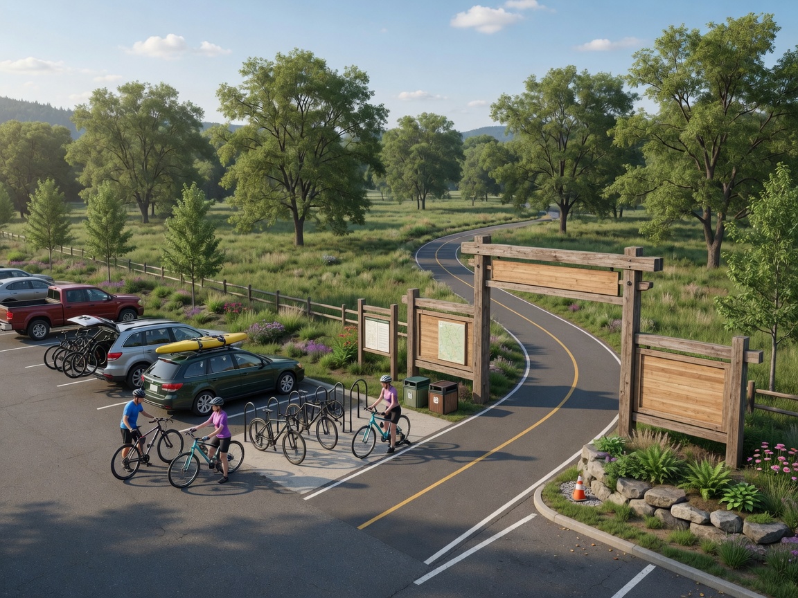
And because the site sits minutes from Highway 401 β€” literally the closest point on the river network for anyone arriving from Toronto and the east β€” it's the perfect trailhead gateway: park the car, unload the bikes, and ride the Thames across the city.

  • TVP terminus nearby β€” direct future connection
  • Existing large parking lot, ready to serve a trailhead
  • Minutes from the 401 β€” London's front door from the east
  • Riverfront frontage along the Thames
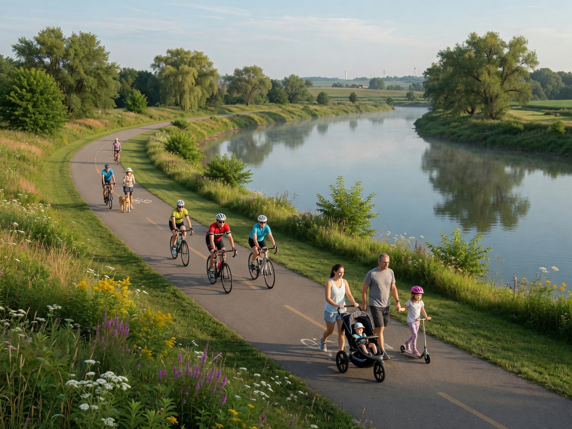
Concept rendering of cyclists on a riverside multi-use path
Concept: the Thames Valley Parkway extended through the River Road lands.

The Vision

A district park in the tradition of London's best

Springbank. Harris. Gibbons. London's identity is built around its riverfront parks β€” but the southeast has nothing on that scale. The east has the excellent East Lions Community Centre; the far southeast still lacks a destination of its own. River Road can change that.

🚴

Cycling & Trail Gateway

A signature trailhead for the TVP and the city's growing multi-use path network β€” parking, bike repair stations, wayfinding, and a direct link toward the existing terminus.

🌊

River Access

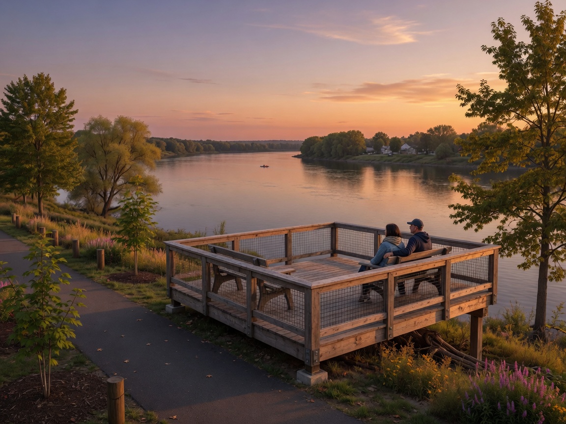
Naturalized banks, lookout points, fishing spots, and potential paddle access β€” reconnecting the east end with the Thames it lives beside.

🌳

Naturalization & Habitat

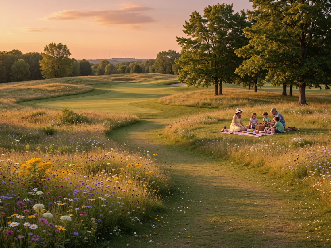
Fairways rewilded into meadow and floodplain forest, with the property's mature trees retained β€” carbon capture, flood resilience, pollinators, birding, and a real contribution to London's tree canopy goals.

🧺

Gathering Places

Picnic groves, an events lawn, a playground, and winter uses like tobogganing and cross-country ski loops β€” a true four-season district park.

🏘️

A Win for the Neighbourhood

The residential community immediately east gains a front-yard park instead of more industrial traffic on a street already overrun by trucks β€” and the Gore–Hamilton–Clarke triangle, a residential pocket with little amenity access today, gains a direct trail connection to a true district park.

πŸ—ΊοΈ

A Destination for the Region

The first riverfront stop off the 401 from the GTA β€” putting London's trail network on the map for day-trippers and cycle tourists.

Why a Park Makes Sense

The land has already decided

Most of it is floodplain

The majority of the property sits in the Thames floodplain, where buildings can't go. The highest and best use of floodplain land is exactly what a park is: trails, trees, meadows, and open space.

The infrastructure exists

A large parking lot is already on site. That's the single most expensive piece of a trailhead gateway β€” and it's sitting there, built and paid for.

Industrial doesn't fit here

A residential neighbourhood borders the lands to the east, and River Road is a designated no-truck route that already suffers heavy truck traffic from existing businesses. Adding light industrial would put more trucks on a crumbling street beside people's homes β€” and squander irreplaceable riverfront.

It banks London's tree canopy

London's Urban Forest Strategy targets 34% tree canopy cover by 2065, up from roughly 24% today. The former course holds decades of mature trees, already grown and already sequestering carbon. Keeping them as parkland locks in progress toward the canopy goal β€” clearing them for industrial pads would move the city backwards on its own environmental commitments.

The southeast is overdue

New district parks in London arrive with suburban growth β€” the newest, Foxfield District Park, serves the booming northwest. The far southeast has nothing comparable, and the city's flagship riverfront parks were all established generations ago. This is the southeast's turn, on land the public already owns.

The city's own report agrees

The land use study commissioned by the City of London recommends 46 of 54 hectares become a public park with a Thames Valley Parkway extension. The plan exists. It needs momentum.

"We're excited to have the opportunity to have this large park and open space along the river and in a location of the city that's underserviced, in the far southeast."

β€” Scott Stafford, Director of Parks and Forestry, City of London

Concepts & Renderings

Imagining River Road Park

Early concept imagery to help Londoners β€” and council β€” picture what this land could become.

🎨 Design your own park

Open the park designer and build your vision on the real footprint of the lands β€” draw trails, place playgrounds, lookouts, splash pads and more, suggest a park name, and submit it. Approved designs appear in the community gallery.

Open the Park Designer See Community Designs

Community Voices

Why Londoners want this park

"I've lived east of the old course for twenty years. We watched the trucks take over the road β€” a park would finally give this neighbourhood something back."

β€” Placeholder testimonial (replace with real submissions)

"The TVP is the best thing about cycling in London. Extending it to River Road with real parking means my whole club can start rides there."

β€” Placeholder testimonial (replace with real submissions)

"Springbank is a treasure, but it's a long way from the east end. Our side of the city deserves a riverfront park of its own."

β€” Placeholder testimonial (replace with real submissions)

Add your voice

Your story is the most powerful tool we have. Tell us what River Road Park would mean to you.

Get Involved

Help fast-track River Road Park

βœ‰οΈ Write to Council

Tell your ward councillor and the mayor you support the full district park plan and a Thames Valley Parkway extension at River Road.

Find Your Councillor

πŸ—£οΈ Share Your Story

Submit a testimonial above. Real voices from real Londoners are what move public decisions.

Add Your Voice

πŸ“’ Spread the Word

Share this site with neighbours, cycling clubs, running groups, naturalists β€” anyone who'd love 133 acres of riverfront park.

Share the Site